


Rich PV module/inverter/meteorological database
It integrates a comprehensive database of PV modules and inverters from leading manufacturers, enabling precise retrieval by manufacturer and device type, thus facilitating efficient and rapid device selection.
For device data not included in the software, various device parameters can be configured user-defined based on the official technical documentation provided by the manufacturer, to accommodate special devices and personalized project requirements.
Built-in rich and standard PAN/OND files can be directly used to create devices, and it also supports importing third-party PAN/OND files, providing flexible expansion.
After positioning the coordinates of the project, meteorological parameters such as irradiation, temperature, and wind speed can be automatically loaded. Meteonorm, NASA, and PVGIS support free access, and it is also compatible with Solargis format meteorological data or user-defined data import.
Learn more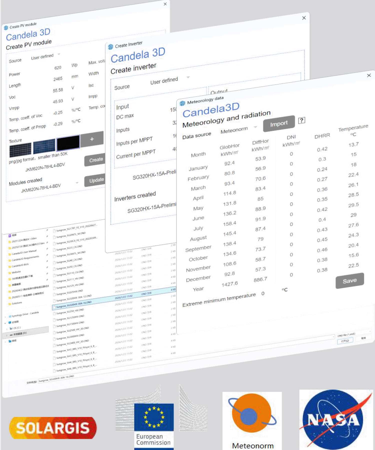





Generation of 3D terrain from multi-source, with powerful terrain analysis capabilities
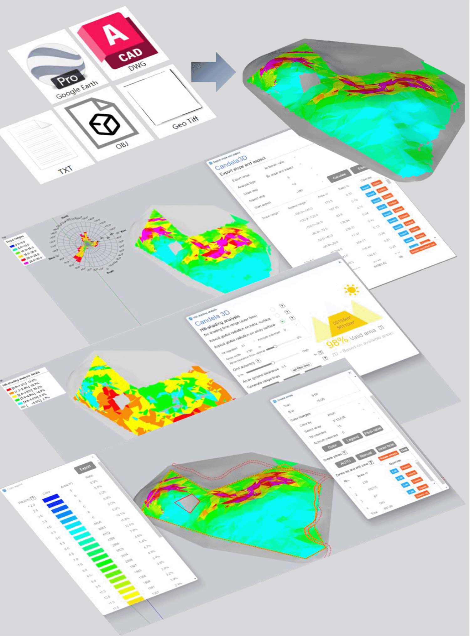
Supports contours, Geo tiff, Obj, txt as well as built-in satellite terrain, enabling rapid generation of 3D terrain models and precise restoration of topographical features.
Support natural slope, N-S Direction slope, E-W Direction slope, and custom aspect slope. Terrain filtering analysis can be conducted using single or multiple parameter combinations to achieve precise assessment and compliance screening of terrain conditions.
For complex upland terrain, regional quantitative screening can be conducted based on sunlight duration, horizontal surface irradiation, or array surface irradiation, to accurately identify suitable areas that meet the conditions for photovoltaic power station construction.
For the qualified and available areas that have been Start, analyze and color the terrain based on array pitch, terrain slope angle, or terrain slope direction, providing intuitive and efficient guidance for the planning of PV arrays' zones, and achieving rapid division of the PV layout area.
Learn more


Support multiple types of arrays, efficiently deploy algorithms to precisely adapt to different scenarios
It covers Fixed-tilt and Horizontal tracker. Flexible racks can be used for complex sites. It supports span array-level string planning at the PV module level.
Based on the terrain conditions, different pitch layout forms can be adopted: custom pitch, auto fixed pitch, and auto vary pitch type, accurately adapting to different terrains. It can also meet the layout requirements of special terrains such as terraces and water surfaces.
Supports various layout alignment methods such as No, Yes, and Align by specified Angle.
The system can perform combined optimization on parameters such as photovoltaic tilt, azimuth, and row and column spacing, supporting intelligent arrangement with installed capacity, production, CPEX, and investment return rate as the optimization goals.
Learn more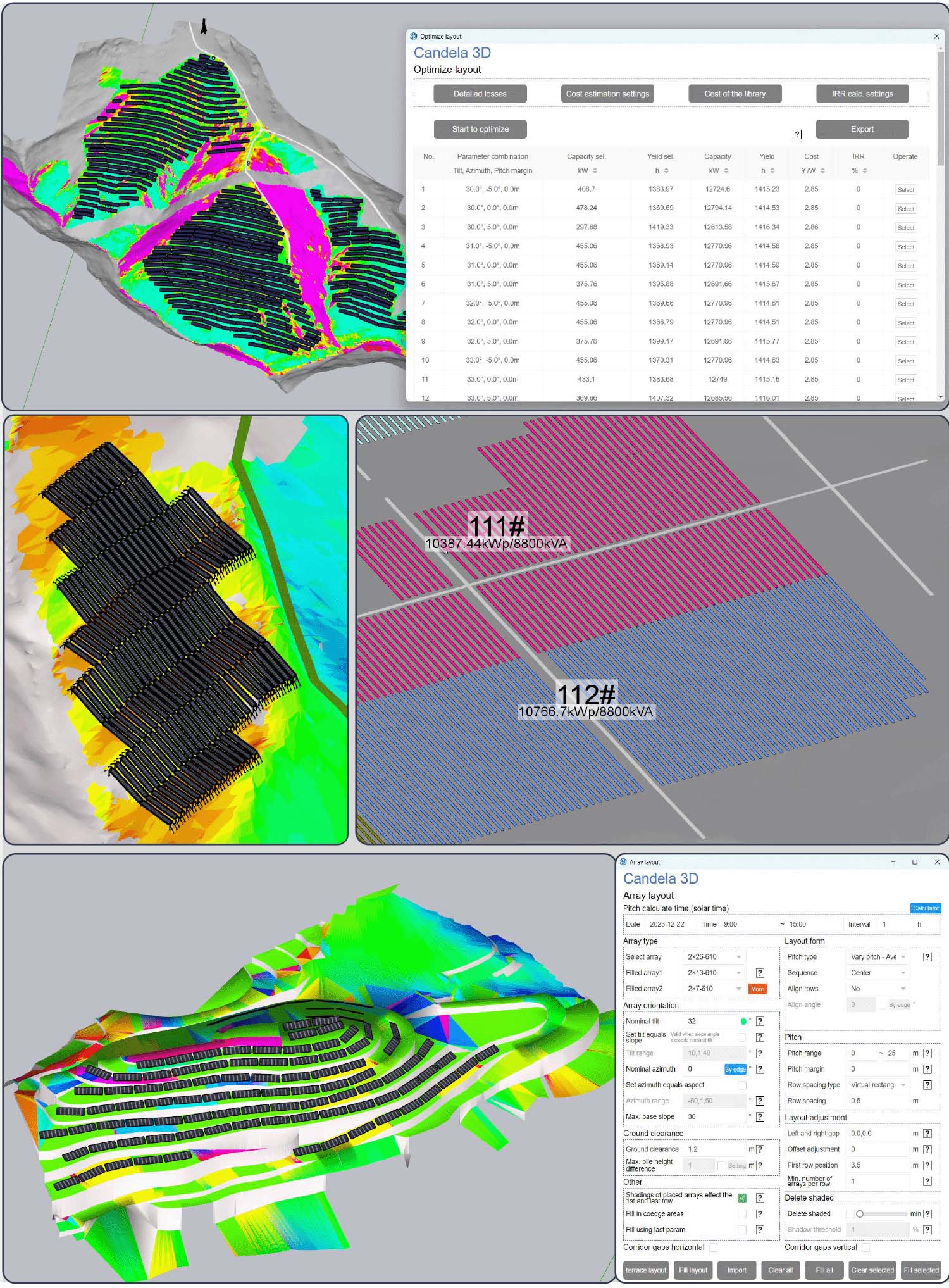


Excellent and diverse occlusion analysis tools
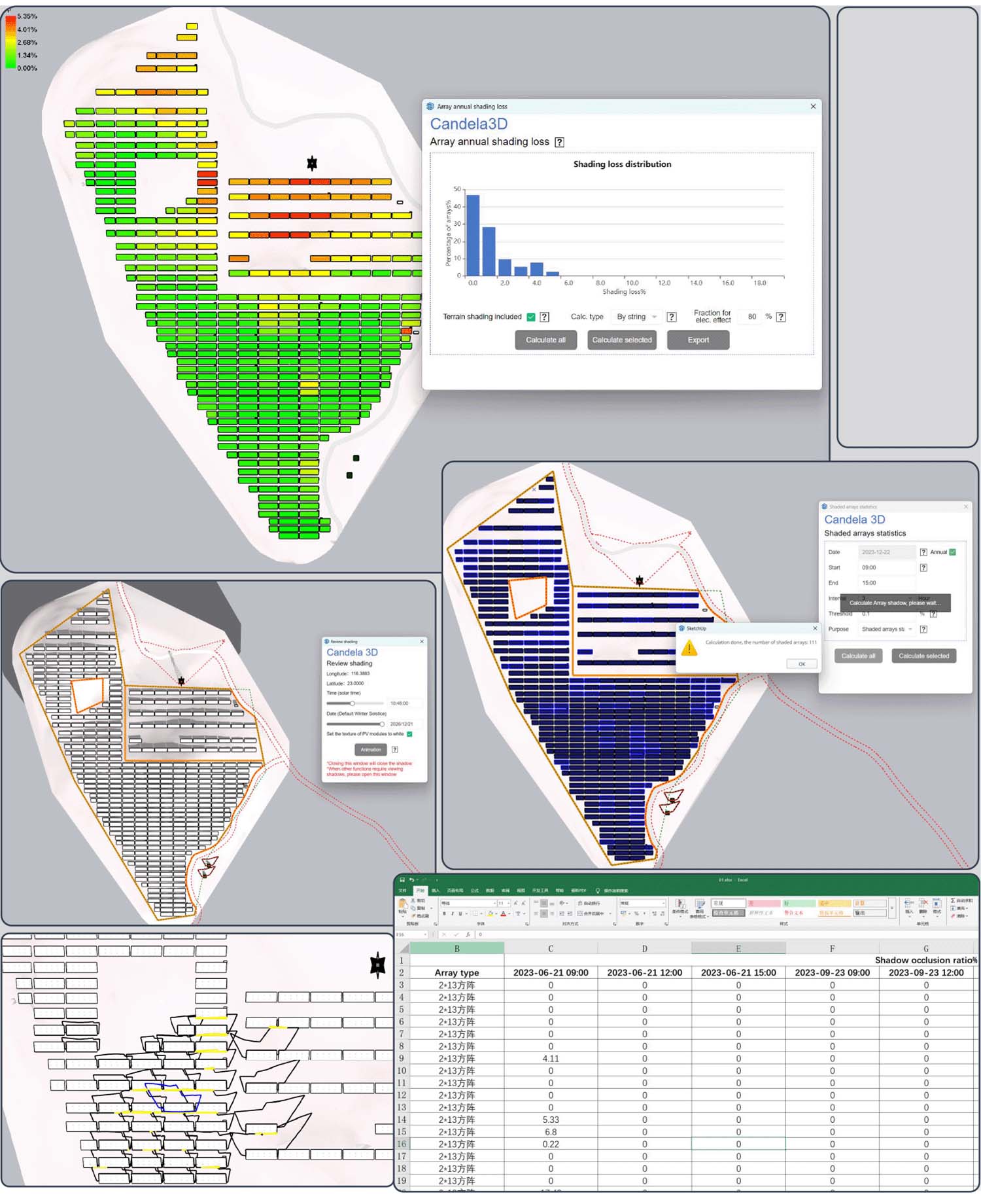
The system can calculate the annual irradiation data for each array before and after shading, and simultaneously count the proportion of loss due to shading in the array. This allows for the deletion of arrays with high loss based on irradiation, and provides accurate data support for the energy efficiency evaluation of photovoltaic power plants.
Support dynamic shading review by time or user-defined time range, which can visually display the shading status of arrays and shading objects at different time ranges, allowing for precise inspection of shading conditions.
Based on the set Time range, the Shaded ratio of the arrays is automatically calculated, and a statistical table of shaded ratios can be exported. Additionally, it supports selecting and deleting shaded and unqualified arrays.
You can set any time period, automatically set filter area, and support importing the shadow range line into 2D CAD, adapting to the subsequent design process.
Learn more




Rich and comprehensive shading object model library
Built-in standard model libraries for common obstructions such as houses, Cable, MvLinkPoint, trees, WTGs, Lightning arresters, cuboids, and fences can save the complicated modeling process. They can be quickly selected according to needs, providing efficiency and convenience.
Supports batch import of shading objects based on coordinates, with the flexibility to modify individual or all size parameters.
For shading objects not included in the built-in model library, it supports independent drawing modeling, and can also import third-party 3D models and define them as shading objects to participate in calculations.
It can perform shadow range calculations on all or selected shading objects, accurately assessing the impact of shading on arrays and assisting in optimizing the layout plan of photovoltaic arrays.
Learn more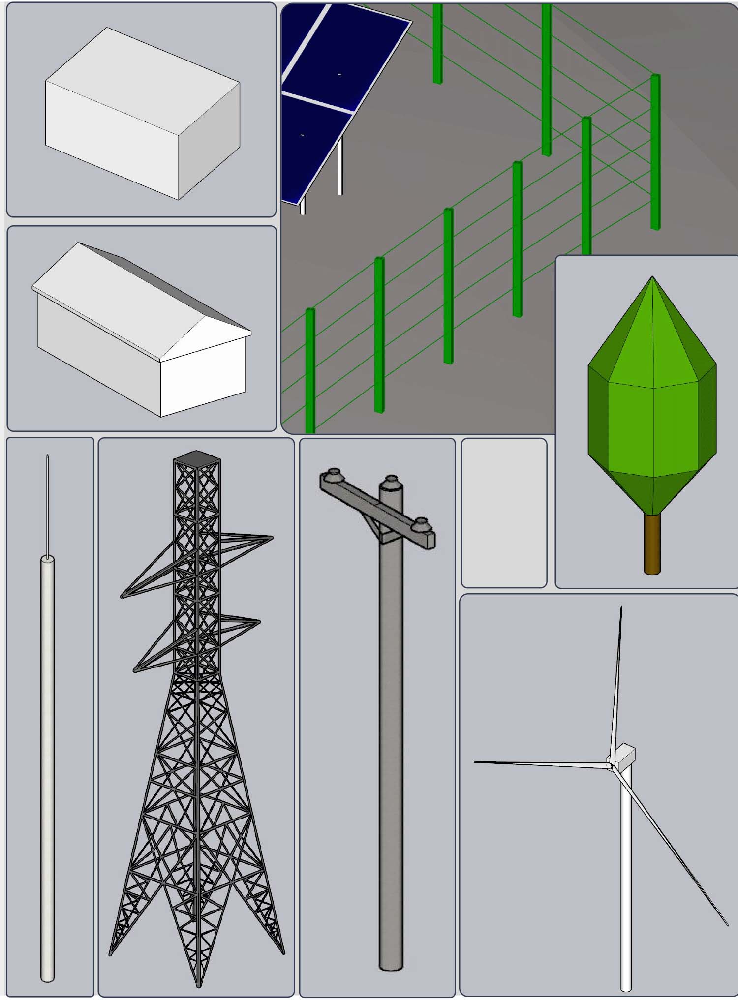






Complete electrical system functions,Efficient and precise Material Count
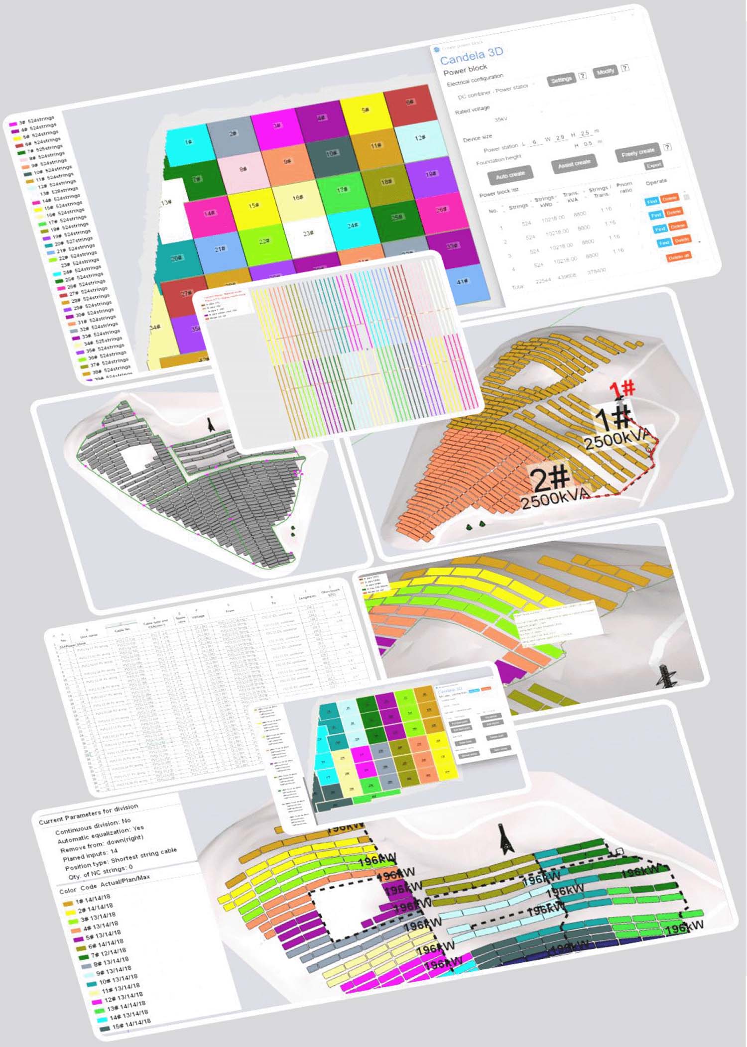
Based on different Electrical configurations and voltage levels, the photovoltaic field is divided into several power blocks. Three methods are provided: Free creation allows for manual and flexible adaptation to irregular fields; Assist create is semi-automated, with auxiliary lines for efficient division of regular fields; Auto create generates intelligent grouping solutions, suitable for large-scale flat-ground projects.
Used within the power block to complete the electrical connection from Pv strings to the Containerized Transformer. Supports intelligent positioning of devices, manual and automatic drawing of cable routes, manual and automatic division of string areas, and allows for cable viewing and optimized routing path planning.
The Cable list allows for hierarchical parameter settings, automatic calculation of cable length, voltage drop, and cross-section, supports tray-based and custom exports, and exports a complete Cable list and calculation sheet.
Cable laying statistics supports multiple configuration methods such as cable tray, cable conduit, and buried, intelligently matches material specifications, accurately counts usage, and exports a material list.
Generate the horizontal grounding grid, vertical grounding electrodes, and device grounding connections for the site step by step, supporting parameterized configuration, manual editing, material statistics, and CAD export, to fulfill the entire process of grounding design for photovoltaic projects.
Learn more

Multi-dimensional intelligent iteration, with multi-parameter constraints on the rack, achieves the minimum earthwork volume
It adapts to undulating terrain, completes terrain leveling and rack parameter adjustment for Unlimited trackers 2D or Fixed-tilt racks, supports sub-plot leveling, iterative optimization, and export of earthwork results, ensuring compliance with earthwork construction and rack installation.
Adjust the array base slope and pile height according to the set parameters, level the terrain and generate the earthwork grid, automatically output the site leveling results folder, and meet the rack installation requirements.
Export the site leveling results and earthwork data, support viewing the arrays and terrain profiles before and after optimization, and quickly verify the compliance of elevation differences and slopes.
Manually/Auto Modify the elevation of the earthwork grid endpoint method, and import external terrain files to correct ponding, Pile length, and Height discrepancies. Supports iterative site leveling.
One-click switch to show the original terrain or the terrain after site leveling, facilitating subsequent designs such as cable length statistics and production calculation based on the leveled terrain, ensuring the data is consistent with that after site leveling.
Learn more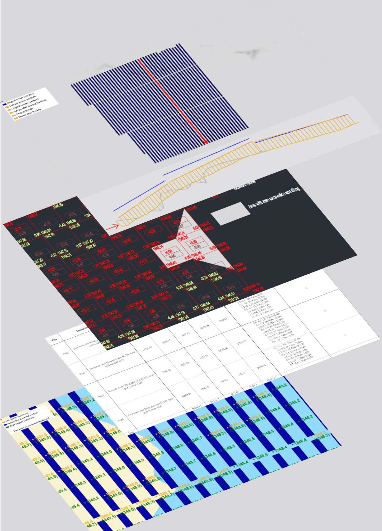





Run Simulation dual mode: 288 hours high efficiency, 8760 hours precision
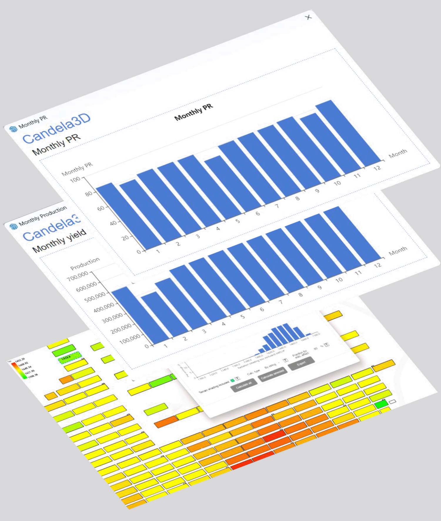
Each month, a typical 24-hour day is selected for representative calculation. Based on a three-dimensional model and Month meteorology data, the production is calculated, with irradiation accuracy down to individual arrays. Various system losses can be user-defined, and the calculation is fast, supporting local accounting and output results.
The core of yield simulation involves high-precision hourly modeling throughout the year, encompassing meteorological and device modeling, multi-dimensional loss quantification, bifacial gain calculation, grouping simulation, and result output, supporting the full-cycle yield evaluation and optimization of photovoltaic power stations.
Learn more

Multiple plans to achieve bidirectional conversion between SU 3D and CAD 2D
It can export planar CAD and electrical system diagrams, supports user-defined export items, and supports the export of CAD viewport range lines, meeting the depth requirements of construction drawings.
Export the site leveling results and earthwork data, support viewing the arrays and terrain profiles before and after optimization, and quickly verify the compliance of elevation differences and slopes.
Manually/Auto Modify the elevation of the earthwork grid endpoint method, and import external terrain files to correct ponding, Pile length, and Height discrepancies. Support iterative site leveling.
Learn more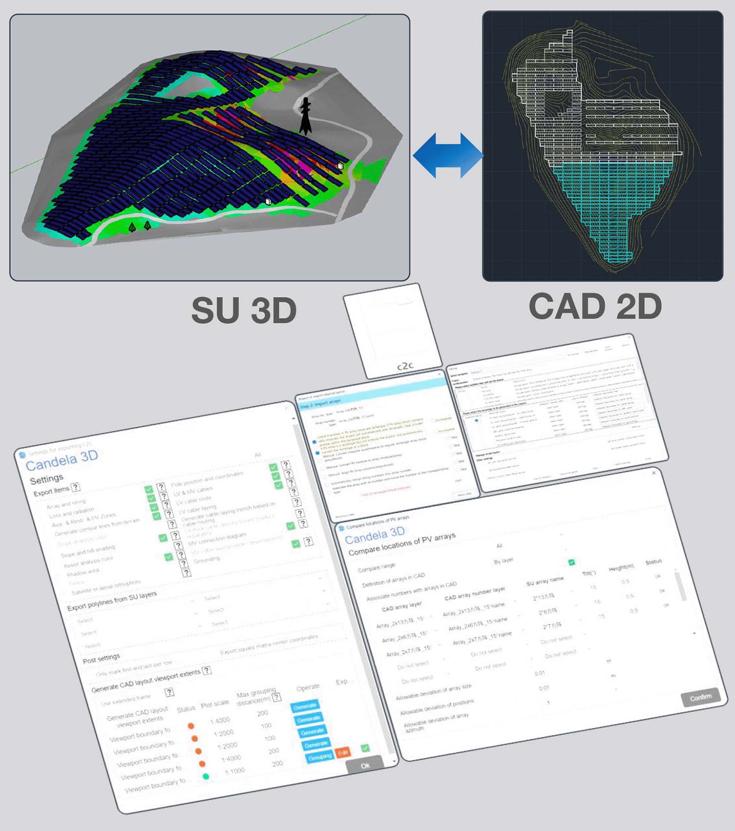
Overview of Major Achievements
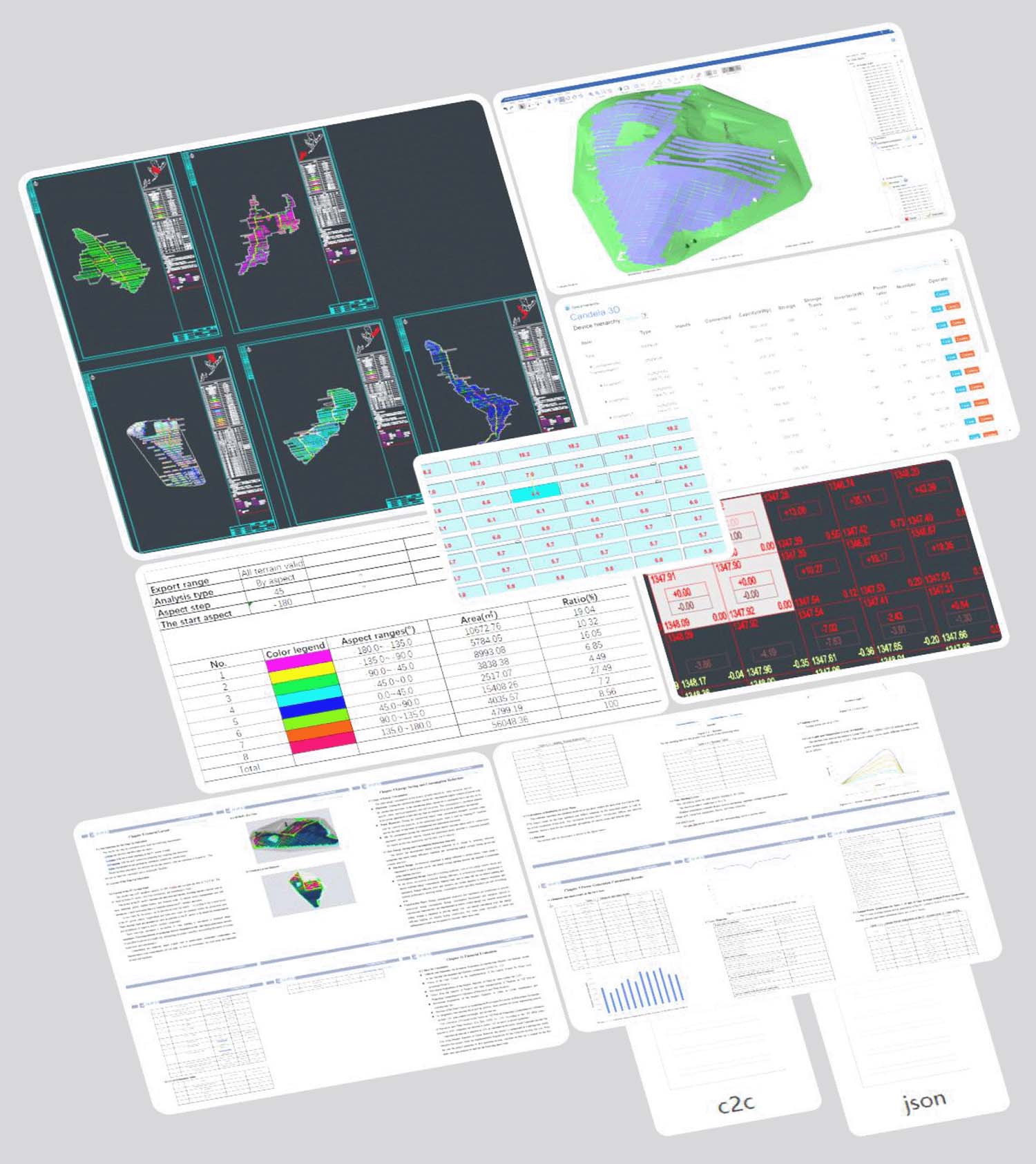
Generate c2c files for layout diagrams, json files for system diagrams, cable lists, earthwork grids, and json files for sectional diagrams.
It can export in two formats: DAE and H2P.
Design Report, Production Simulation Report, Cable Voltage drop Calc. Report.
Terrain analysis table, array theoretical pitch table, array optimization layout table, array surface irradiation loss table, array shaded ratio table, combine device economic comparison table, array statistical analysis table, cost estimation table, power generation calculation table, financial indicator table, scheme comparison table.
BOM, Device hierarchy, Layout area information table, Power block information table, Pile position coordinate table, Grounding material table, Cable laying material table.
Learn more