| Create Terrain | |
 | Terrain in Candela3D can be created by: 1. Import CAD contour-lines. 2.Download satellite terrain in SketchUp. 3.Created terrain model by SketchUp. |
| Terrain Analysis | |
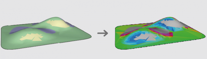 | Through the hill-shading analysis, slope analysis and pitch calculation to find the areas that fit the requirements of layout. |
| Layout | |
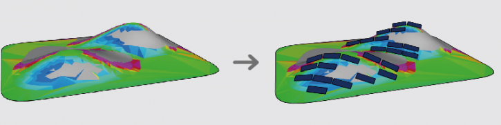 | Base on the terrain and user settings, the pitch can be automatically calculated and the arrays can be automatically placed. This feature greatly improves the layout efficiency, increases the layout capacity and improves the energy yield of the project. |
| Road and shading objects | |
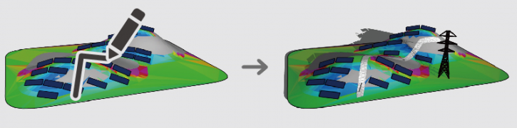 | Use polylines imported from CAD, or the center-line drawn by Sketchup pencil tool to create roads, and remove the arrays along the road. Insert the shading objects models, such as trees, houses, electric towers, electric poles, wind turbines, etc. to analysis their shadow effect. |
| Power-block division, cable path defination, auto electrical connections | |
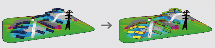 | Candela3D can automatically complete the electrical wiring from the strings to the transformer after the power blocks are created, display the 3D cable route, and export the cable list. |
| Export results | |
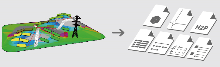 | Supports the view of device hierarchy of the PV system, and can export 2D / 3D CAD drawings, BOM, cable list, post list and PVsyst model file. |
| Convert 2D CAD layout to 3D model | |
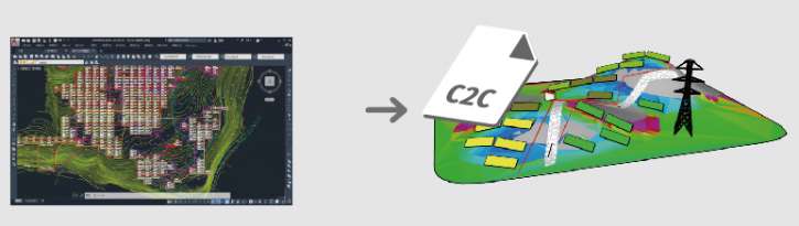 | The 2D layout of PV arrays in CAD can be imported into Sketchup through C2C file for generating 3D model, which can be used to shading analysis or export to PVsyst for energy yield calculation. |