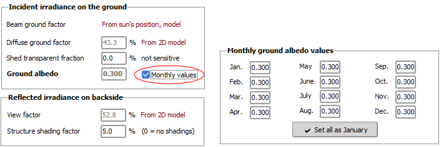
1. After changing the terrain albedo, why doesn't the result of batch simulation change?
Answer: When users select "Monthly Data" when setting the terrain reflectivity, as shown in the figure, changing the terrain reflectivity during batch simulation may result in no change in the production data, provided that other variables remain unchanged.
2. In the same region, will different elevations cause significant radiation differences?
Answer: The shorter the path of solar radiation through the atmosphere (the higher the elevation), the less it is weakened by the atmosphere, and the higher the radiation that reaches the terrain will be.
Therefore, when importing meteorology data, it is necessary to accurately fill in the altitude of the project site. As shown in the figure, there are certain differences in horizontal plane radiation and scattered radiation between Beijing at an altitude of 200m and 55m.

3. What does the height above ground of bifacial modules refer to?
Answer: For double-sided components using a fixed rack type, the height above ground refers to the lowest point of the component above the ground. For double-sided components using a horizontal tracker, the height above ground refers to the elevation of the main axis of the tracker above the ground.
4. How to output the monthly production data for each year over a span of 25 years?
Answer: Currently, the software does not support the one-time export of monthly production data for 25 years. You can follow the steps below to operate.
① First, in the "Output Export data" option, select "File name". The system will automatically fill in the name of the file, or you can define it yourself. As shown in the figure, the default is XXX7.CSV, which means the first year is XXX7.CSV file, the second year is XXX8.CSV, and so on. Select "E_grid" for the variable on the right.
② Return to the "Aging tool" interface and select "Generate output file".
③ Click "Run" to simulate the production over multiple years. After the simulation is complete, return to the local user workspace → "UserHourly" to find the exported data files. For example, if the simulation covers 25 years, there will be 25 CSV files.

▲Figure: Settings Export data
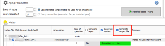
▲Figure: Setting Output File
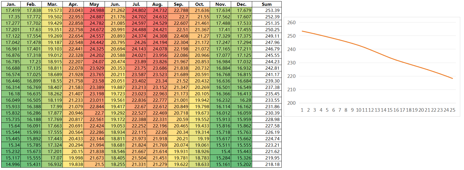
▲Figure Monthly Data Compilation for 25-Year
5. What is the irradiation optimization of the tracking system?
Answer: Choose the tracking bracket method, and you can see the "Irradiance optimization" option, as shown in the figure.

On non-sunny days, such as cloudy, overcast, or rainy days, the radiation received by PV modules is primarily scattered and reflected.
The diffuse reflection has a positive proportional relationship with (1 + 0.5cosβ), where β represents the angle between the PV modules and the horizontal plane. Therefore, the smaller β is, the higher the irradiance will be. Consequently, the optimal tracking angle on non-sunny days is usually the horizontal position.
On sunny days, the solar radiation received by the surface of the PV modules is primarily direct radiation. By using traditional tracking strategies and back-facing tracking strategies to avoid shadows, the PV modules can be positioned at an angle that maximizes radiation exposure.
The irradiation optimization model in the PVsyst simulation software is designed based on the proportional relationship between diffuse reflection and (1 + 0.5cosβ) under non-sunny conditions, which can overcome the shortcomings of traditional tracking algorithms.
Note: The software version used for the above Q&A is PVsyst7.2.4
Article Comments(0)