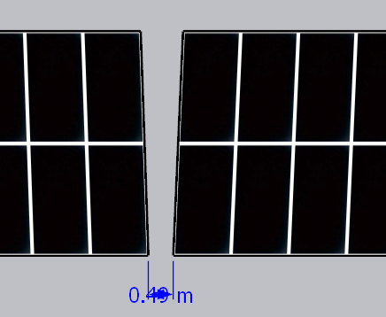
The spacing between PV arrays in the E-W Direction, as the name suggests, is as shown in the figure below. It seems that there is no room for discussion, so it is often skipped.
However, the actual layout process of a project in Complex terrain is not as straightforward as it seems. This is mainly due to the following two reasons:
1)The arrays are arranged according to the terrain, and as the length and width of the array's projection change, the shape of the Parallelogram also changes;
2)Traditional drawing still treats arrays as unchanging rectangles for layout.
For the above item 1), to control the actual East-west spacing to a set value (such as 0.5 meters), it can be achieved through a step-by-step method. This is actually not difficult.
Regarding the aforementioned point 2), it is actually the reason that complicates the issue.
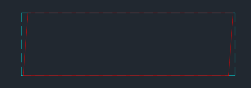
From a two-dimensional projection, the actual arrays in mountainous terrain appear as a varying Parallelogram (represented by the red line), whereas the traditional drawing shows a fixed Rectangle (represented by the blue dashed line, a Virtual rectangle). The centers of the two are aligned.
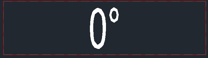
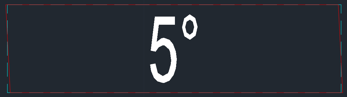
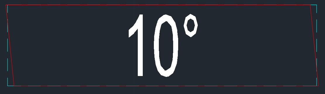
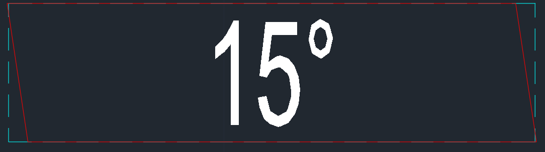
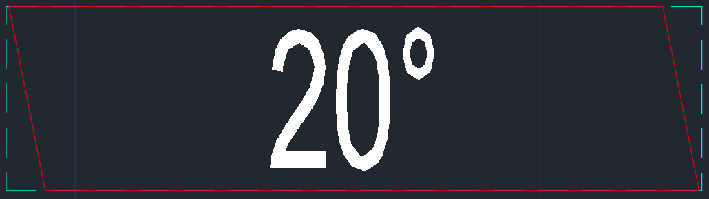
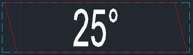
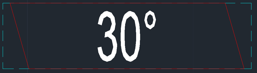
But is it necessarily true that a parallelogram must lie within a virtual rectangle? Let's take an example where the array tilt is 30° and the base slope ranges from 0° to 30°. The results are shown in the figure below. It can be observed that when the base slope is 0°, the parallelogram coincides with the virtual rectangle; when the base slope is at 5°, 10°, and 15°, the corner points of the parallelogram are already outside the virtual rectangle; when the base slope exceeds 20°, the parallelogram has completely enclosed within the virtual rectangle, and its side length becomes shorter as the base slope increases.
It is quite simple to control the East-west spacing of a Virtual rectangle to a set value. However, there are two issues:
1)When the East-West slope is steep, the actual East-West spacing is too large, as can be seen in the above figure.
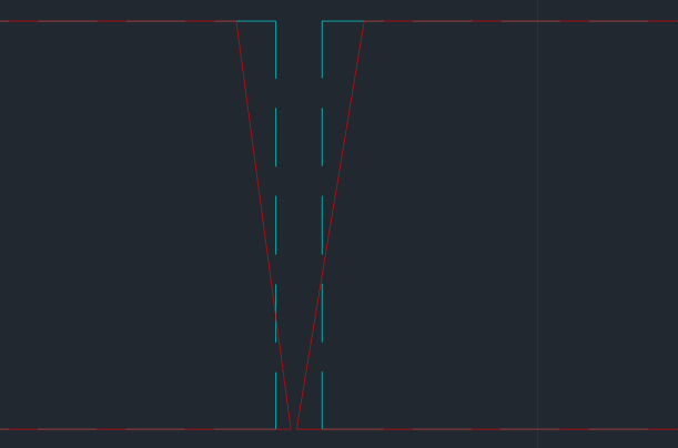
2)When two adjacent arrays are located on either side of a ridge or valley, there may be an issue where the actual East-West spacing is too narrow, as illustrated in the figure below.
Therefore, for mountainous photovoltaic projects, it is recommended to control according to the actual East-West spacing (the layout speed will be slightly slower). The layout effect is as follows. Regardless of how the terrain changes, the actual East-West spacing can be accurately controlled to the set value.
Article Comments(0)